Introduction to the Skill of Understanding Map Projections
Imagine navigating a world without maps – it’s a daunting task, honestly. The skill of understanding map projections is essential for making sense of our surroundings, and it starts with a surprising fact: did you know that no map projection can perfectly represent the Earth’s surface? As we explore the world of map projections, we’ll discover the importance of understanding the basics, types, and distortions of map projections, and how to apply this knowledge in real-world scenarios.
We’ll delve into the world of cartography, where map projections play a crucial role in creating accurate and informative maps. But first, let’s consider a question: what if map projections could change the way we perceive the world? The answer lies in understanding the concepts of map projections, and we’ll start by defining what map projections are and their purpose.
What Are Map Projections?
Definition of Map Projections
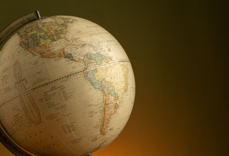
Map projections are a way of representing the Earth’s surface on a flat map, and they’re used in various fields, including geography, navigation, and urban planning. Think of it like trying to wrap a sphere with a piece of paper – it’s a complex task that requires some compromises. The Geographic Coordinate System, which defines the angular measurements on the Earth, is a fundamental concept in understanding map projections.
For instance, the Mercator projection, developed by Gerardus Mercator in 1569, is a famous example of a map projection that preserves shape and local direction. However, it distorts the area of objects away from the Equator, making it less suitable for representing the Earth’s surface accurately.
Role in Cartography
Cartographers use map projections to create accurate and informative maps, but it’s a challenging task. They must balance accuracy and aesthetics, considering factors like scale, shape, and distance. The National Geographic Society has a wealth of resources on map projections, including a guide to understanding the different types of projections and their applications.
Let’s take a look at the work of Abraham Ortelius, a famous cartographer who created the first true modern atlas, Theatrum Orbis Terrarum, in 1570. His work demonstrates the importance of understanding map projections in creating accurate and informative maps.
Examples of Common Projections
There are several common types of map projections, including the Mercator, Robinson, and Gall-Peters projections. Each has its strengths and weaknesses, and they’re suited for different purposes and regions. The Robinson projection, for example, is a compromise between the area and the shape of the world, making it a popular choice for general-purpose maps.
On the other hand, the Gall-Peters projection preserves area, but distorts shape and direction. Understanding the characteristics of each projection is crucial for choosing the right one for a particular application.
The Basics of the Earth’s Shape
Earth as a Sphere or Ellipsoid
The Earth is not a perfect sphere, but an oblate spheroid, meaning it’s slightly flattened at the poles and bulging at the Equator. This shape affects the way we perceive and represent it on maps, including the concept of scale. The polar radius of the Earth is roughly 6356.75 km, and the equatorial radius is about 6378.14 km.
For instance, the World Geodetic System (WGS) is a universally adopted geographic coordinate system that uses horizontal rings (parallels) and vertical semicircles (meridians) to divide the globe into sectors. Understanding the Earth’s shape is essential for creating accurate map projections.
Challenges in Flattening the Globe
Flattening the globe onto a 2D surface is a complex task that always introduces distortions. Cartographers must balance the preservation of shape, area, distance, and direction, but it’s impossible to preserve all four aspects simultaneously. The transformation process, called map projection, affects every spatial analysis we perform.
Let’s consider a micro-story: imagine you’re a navigator trying to chart a course across the ocean. You need to understand the distortions in your map projection to avoid getting lost or misjudging distances. The skill of understanding map projections is crucial for making informed decisions in various fields.
Why Projection Is Necessary
Map projections are necessary for representing the Earth’s surface, but they’re not perfect. They enable us to communicate complex geographic information in a clear and concise manner, but they also introduce distortions. Understanding these distortions is essential for accurate map interpretation and analysis.
For example, the Web Mercator projection, used by several online map services, including Google Maps, introduces significant distortions in area and shape, especially near the poles. Recognizing these distortions is crucial for making informed decisions in applications like navigation and urban planning.
Types of Map Projections
Cylindrical Projections
Cylindrical projections, like the Mercator projection, preserve shape and local direction, but distort area and distance. They’re suitable for navigation and mapping at small scales, but not for representing the Earth’s surface accurately.
On the other hand, conic projections, like the Albers conic projection, preserve shape and distance within a small area, making them suitable for mapping at medium scales.
Conic Projections
Conic projections are used for mapping at medium scales, where preserving shape and distance is crucial. They’re commonly used for topographic maps and are suitable for representing the Earth’s surface in a relatively small area.
Azimuthal projections, like the stereographic projection, preserve angles between directions on a map, but distort distances and areas. They’re suitable for mapping at large scales, where preserving direction is essential.
Azimuthal Projections
Azimuthal projections are used for mapping at large scales, where preserving direction is crucial. They’re commonly used for navigation and are suitable for representing the Earth’s surface in a relatively large area.
Other projection families, like pseudo-cylindrical and polyconic projections, offer alternative ways of representing the Earth’s surface. Each has its strengths and weaknesses, and understanding their characteristics is essential for choosing the right one for a particular application.
Distortions in Map Projections
Understanding Distortion Types
There are four main types of distortions in map projections: area, angle, distance, and shape. Understanding these distortions is essential for accurate map interpretation and analysis. The skill of understanding map projections involves recognizing and mitigating these distortions.
For instance, the Mercator projection distorts the area of objects away from the Equator, making it less suitable for representing the Earth’s surface accurately. On the other hand, the Gall-Peters projection preserves area, but distorts shape and direction.
Area, Shape, Distance, and Direction
Map projections can distort area, shape, distance, and direction, and understanding these distortions is crucial for accurate map interpretation and analysis. The transformation process, called map projection, affects every spatial analysis we perform.
Let’s consider a micro-story: imagine you’re an urban planner trying to design a new city. You need to understand the distortions in your map projection to avoid misjudging distances and areas. The skill of understanding map projections is essential for making informed decisions in various fields.
Visualizing Distortion Patterns
Visualizing distortion patterns is essential for understanding map projections. Tissot’s indicatrix is a tool used to visualize these patterns, and it helps cartographers and analysts recognize the distortions in their maps.
For example, the Web Mercator projection introduces significant distortions in area and shape, especially near the poles. Recognizing these distortions is crucial for making informed decisions in applications like navigation and urban planning.
The Skill of Understanding Map Projections
Interpreting Projection Information
Interpreting projection information is essential for understanding map projections. Cartographers and analysts need to extract relevant information from map projections, including the identification of projection types and parameters.
For instance, the Mercator projection is a cylindrical projection that preserves shape and local direction, but distorts area and distance. Understanding these characteristics is crucial for choosing the right projection for a particular application.
Comparing Different Projections
Comparing different map projections is essential for understanding their strengths and weaknesses. Cartographers and analysts need to evaluate the trade-offs between preserving shape, area, distance, and direction in different projections.
Let’s consider a micro-story: imagine you’re a navigator trying to chart a course across the ocean. You need to understand the distortions in your map projection to avoid getting lost or misjudging distances. The skill of understanding map projections is crucial for making informed decisions in various fields.
Recognizing Distortions in Practice
Recognizing distortions in practice is essential for accurate map interpretation and analysis. Cartographers and analysts need to identify the distortions in their maps and mitigate them to make informed decisions.
For example, the Gall-Peters projection preserves area, but distorts shape and direction. Understanding these characteristics is crucial for choosing the right projection for a particular application.
Selecting the Right Projection
Factors to Consider
Selecting the right projection involves considering several factors, including the purpose of the map, the region of interest, and the scale. Cartographers and analysts need to evaluate these factors to choose the most suitable projection for their application.
For instance, the Mercator projection is suitable for navigation and mapping at small scales, but not for representing the Earth’s surface accurately. On the other hand, the Robinson projection is a compromise between the area and the shape of the world, making it a popular choice for general-purpose maps.
Matching Projection to Purpose
Matching a map projection to its intended purpose is essential for effective communication. Cartographers and analysts need to consider the audience and the context in which the map will be used to choose the most suitable projection.
Let’s consider a micro-story: imagine you’re an urban planner trying to design a new city. You need to understand the distortions in your map projection to avoid misjudging distances and areas. The skill of understanding map projections is essential for making informed decisions in various fields.
Examples of Use Cases
Map projections have various use cases, including navigation, urban planning, and environmental monitoring. Each application requires a different type of projection, and understanding the characteristics of each projection is essential for choosing the right one.
For example, the Web Mercator projection is used by several online map services, including Google Maps, due to its ability to preserve shape and local direction. However, it introduces significant distortions in area and shape, especially near the poles.
How to Read Projection Metadata
Deciphering Legends and Labels
Deciphering legends and labels in map projections is essential for understanding the metadata. Cartographers and analysts need to extract relevant information from map projections, including the identification of projection types and parameters.
For instance, the Mercator projection is a cylindrical projection that preserves shape and local direction, but distorts area and distance. Understanding these characteristics is crucial for choosing the right projection for a particular application.
Key Terms in Projection Metadata
Key terms in projection metadata include projection type, scale, and datum. Understanding these terms is essential for accurate map interpretation and analysis, and for choosing the right projection for a particular application.
Let’s consider a micro-story: imagine you’re a navigator trying to chart a course across the ocean. You need to understand the distortions in your map projection to avoid getting lost or misjudging distances. The skill of understanding map projections is crucial for making informed decisions in various fields.
Practical Exercises for Skill Improvement
Identifying Projections by Appearance
Identifying map projections by appearance is an essential skill for cartographers and analysts. They need to recognize the characteristic features of each projection to choose the right one for their application.
For example, the Mercator projection has a distinctive appearance, with straight lines representing longitude and latitude. Understanding these characteristics is crucial for identifying the projection and mitigating its distortions.
Assessing Distortion on Maps
Assessing distortion on maps is essential for accurate map interpretation and analysis. Cartographers and analysts need to evaluate the distortions in their maps and mitigate them to make informed decisions.
Let’s consider a micro-story: imagine you’re an urban planner trying to design a new city. You need to understand the distortions in your map projection to avoid misjudging distances and areas. The skill of understanding map projections is essential for making informed decisions in various fields.
Testing Your Understanding
Testing your understanding of map projections is essential for improving your skills. Cartographers and analysts need to evaluate their knowledge and identify areas for improvement to become proficient in the skill of understanding map projections.
For instance, you can test your understanding by identifying the projection type and parameters used in a map, and by evaluating the distortions introduced by the projection. The skill of understanding map projections is a complex and nuanced one, requiring practice and dedication to master.
Common Misconceptions and Errors
Mistaking Scale Consistency
Mistaking scale consistency is a common misconception in map projections. Cartographers and analysts need to evaluate the scale of their maps to avoid misjudging distances and areas.
For example, the Mercator projection introduces significant distortions in area and shape, especially near the poles. Understanding these characteristics is crucial for choosing the right projection for a particular application.
Ignoring Directional Distortion
Ignoring directional distortion is a common error in map projections. Cartographers and analysts need to evaluate the directional distortion in their maps to avoid misjudging directions and bearings.
Let’s consider a micro-story: imagine you’re a navigator trying to chart a course across the ocean. You need to understand the distortions in your map projection to avoid getting lost or misjudging distances. The skill of understanding map projections is crucial for making informed decisions in various fields.
Assuming All Maps Are Equally Accurate
Assuming all maps are equally accurate is a common misconception in map projections. Cartographers and analysts need to evaluate the accuracy of their maps to avoid misjudging distances and areas.
For instance, the Gall-Peters projection preserves area, but distorts shape and direction. Understanding these characteristics is crucial for choosing the right projection for a particular application.
Resources for Further Learning
Recommended Books and Articles
There are several recommended books and articles on map projections that can inform and improve your understanding of the subject. The National Geographic Society has a wealth of resources on map projections, including a guide to understanding the different types of projections and their applications.
Let’s consider a micro-story: imagine you’re a cartographer trying to create a new map. You need to understand the distortions in your map projection to avoid misjudging distances and areas. The skill of understanding map projections is essential for making informed decisions in various fields.
Online Courses and Tutorials
There are several online courses and tutorials on map projections that can inform and improve your understanding of the subject. The College, Career & Civic Life (C3) Framework for Social Studies State Standards includes Geographic Representations: Spatial Views of the World, which provides a comprehensive introduction to map projections.
For example, the National Council for Social Studies Curriculum Standards include Theme 2: Time, Continuity, and Change and Theme 3: People, Places, and Environments, which emphasize the importance of understanding map projections in social studies education.
Professional Organizations
Professional organizations, such as the National Geographic Society, play a crucial role in promoting best practices and standards in cartography and geographic information systems. They provide a wealth of resources, including books, articles, and online courses, to inform and improve your understanding of map projections.
Let’s consider a micro-story: imagine you’re a geographer trying to understand the spatial patterns of cultural and environmental characteristics. You need to understand the distortions in your map projection to avoid misjudging distances and areas. The skill of understanding map projections is essential for making informed decisions in various fields.
Conclusion and Key Takeaways
In conclusion, the skill of understanding map projections is a complex and nuanced one, requiring practice and dedication to master. By understanding the basics of map projections, including the types of projections, distortions, and metadata, you can improve your skills and make informed decisions in various fields.
Remember, the skill of understanding map projections is essential for accurate map interpretation and analysis, and for making informed decisions in applications like navigation, urban planning, and environmental monitoring. So, take the next step and start practicing your skills today – the world is waiting for you to navigate it with confidence and precision.